


NaviPad Free app for iPhone and iPad
Developer: DivDev
First release : 01 Aug 2011
App size: 8 Mb
Got a boat? Got an iPad or iPhone? Then you should get NaviPad.
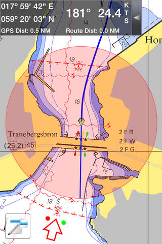
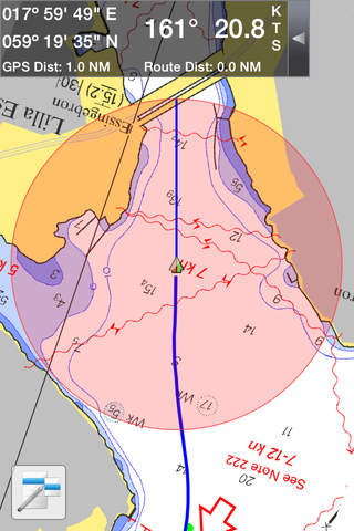
NaviPad uses the built in location service to display your location in real-time on installed chart files.
NaviPad currently supports the BSB/KAP format. The files are uploaded to your device using iTunes file sharing or downloaded by using the "Chart Downloader"
Users have the possibility to publish their favorite places, see other users places and send messages to other users.
Other users of NaviPad will be displayed on the map with speed, course and location information.
To use these "social" functions an account has to be created. The account is created in NaviPad.
You can also share your favorite locations with other users by using the “Share Location” function.
The Registration form will always be displayed when the NaviPad is started and no user id is found.
Plan your routes ahead by performing a long press on the navigation screen and then draw the way you want to travel. The route taken to a place can also be saved and loaded so you can find the way back to your favorite spots again. These routes can also be downloaded in the KML format for usage in other devices or online map services.
NaviPad was created by DivDev in Sweden. Boating and programming enthusiasts!
US, Brazillian and New Zealand navigational charts are included and downloadable in the application.
Latest reviews of NaviPad Free app for iPhone and iPad
Bad User interface, all interesting features not accessible. Pass away.
I use this app all the time when I am on my boat. I loaded it up with raster charts and it works GREAT!
Every few seconds an ad pops up and forces you to wait 10 seconds before you can see the screen again. This is in addition to the banner ad at the top that is constantly taking up part of screen.
Just happy to read my collection of raster charts (Kap files) on iPad. Seems like only app that will do that hence the high score. Difficult to plan and look around, no quilting, no tools to make easy routes etc. Opens one chart at a time. As I said its just nice to have the raster charts, awkward as it is. Also wish information bubbles could be removed that other people put.
The app just crashes when i tap its icon